Map Illustration
by Danielle Marks
Danielle Marks Design
364 Lakeview Drive
Hartfield, VA 23071-3110
804 238-1539
All artwork © 2015
Danielle Marks
The longest section of completed trail
runs from the East Puyallup Trailhead,
where I start this bike ride, eastward
toward South Prairie. A small blue sign
just down the trail catches my eye. It reads,
“If you hear the lahar sirens, move quickly
to high ground (at least 50 feet off the
valley floor).” Lahars are mudflows from
volcanos, and geologists say the broad, flat
valley here was formed by a series of flows
that swept down fromMount Rainier. The
most recent buried this valley under 20
feet of mud some 600 years ago.
Those ancient mudflows made rich
topsoil, which early settlers used for farm-
ing. Eventually they focused on the cut
flower and bulb trades, carpeting the entire
valley in yellow daffodils by the 1920s. The
new industry sparked an annual daffodil
festival and parade that continues today.
Housing, commercial development and
the dairy industry have now covered those
daffodil fields, although a sculpture honor-
ing the daffodil still stands at a crossroads
in Orting.
About four miles down the trail, near
McMillin, a gravel driveway leads through
a trailside field of rhubarb to Scholz Farm.
There’s a produce market as well as shaded
picnic tables. I grab a bottled juice from
the refrigerator and talk to Allen Scholz,
the fourth generation of his family to work
the land here.
Allen admits he wasn’t thrilled to hear
in the 1990s that a trail would replace
the railroad. He was concerned about
trespassers. After the trail opened in 2005,
he changed his tune. His produce market
business picked up as trail users stopped
for nourishment. He began selling juice,
dried fruit and other snacks to this health-
conscious crowd. Many returned in their
cars for larger purchases and became
regular customers. “I’d say the trail’s a good
neighbor,” he tells me.
Back on the trail, I arrive at the
McMillin Trailhead in about a mile and
cross a trestle spanning the Puyallup River,
which runs chalky white as it carries glacier
melt fromMount Rainier. Just down the
trail, housing subdivisions, schools and
commercial development spring up as I
head into Orting. First settled in 1854,
today the town of 6,700 is considered a
bedroom community for the sprawling
Tacoma-Seattle area.
Although I’m barely
seven miles down the
trail, the aromas from
burger joints and
cafés tickle my taste
buds. Craving carbs,
I choose the Orting
Bakery, located
across State Route
162 from the city park.
Munching on a giant
peanut butter cookie, I scan
photos depicting the area’s coal-
mining, logging and agricultural heritage,
and the role played by the Northern
Pacific Railway in getting those goods to
market.
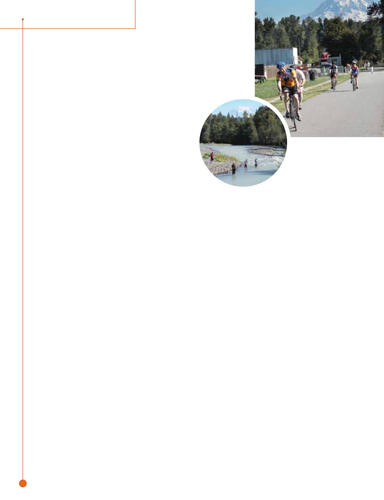
Pedaling out of town past a bike skills
park, I come to the spot that rewards
trail users with awe-inspiring views of
Rainier—weather permitting. This section
can be crowded with people, including
fishermen in the fall. The anglers walk
from parking lots in town to fish for salm-
on, which are returning from the ocean to
spawn in their native creeks and rivers.
Another trestle crosses the Carbon
River near the ghost town of Crocker
about three miles past Orting, and the trail
follows the tamer South Prairie Creek. I
pass a fenced pasture nearby that some-
times holds bison, though only a solitary
emu patrols the land today.
Passing through a low railroad cut, the
trail emerges into farmland and arrives
at the small, aptly named town of South
Prairie. A trailhead and barrier mark the
current end of the trail, as the railroad cor-
ridor enters an area that’s been contested
by private property owners. Pierce County
Parks and Recreation Planner Joseph
Coppo says some former railroad property
beyond the “Do Not Enter” sign has been
acquired for the trail, while remaining
tracts face condemnation. Meanwhile, the
county is seeking a state parks grant to
develop paved trail connections east and
north to completed segments in Buckley
-
trail connections south almost
to the Carbon River entrance at
Mount Rainier National Park.
Everyone who travels the trail to South
Prairie recommends Trailside Connections
Espresso. The drive-through coffee kiosk
sits on the main road, but the owners
cleared out a blackberry thicket at the
trail’s edge, built two shelters with picnic
tables and added a walkway and walk-up
window for trail-users. While I sip an
iced Americano here, the barista tells me
that she gets more business from cyclists
than motorists in the summertime and on
many weekends.
Fortified by caffeine for my return trip,
I stop for a scenic photo along the Carbon
River. Five-year-old twins Marissa and
Colby are chucking some pebbles into the
river, their bikes lying nearby. Parents Nick
and Jessica from Puyallup say they used
to visit the trail for walks when their kids
rode on training wheels. Once the twins
graduated to two wheels, Mom and Dad
couldn’t keep up anymore and bought
their own bicycles. “They got us going,”
Jessica says.
If Doc Tait were around today, he’d
probably like to hear how new generations
continue discovering the Foothills Trail.
Freelance writer Gene Bisbee lives in the
Seattle area. He has explored most rail-trails
in western Washington and regularly writes
about bicycling issues on his blog, BikingBis.
com. He is also the author of the tour guide
“Best Bike Rides Seattle: Great Recreational
Rides in the Metro Area.”
Gene Bisbee (2)
Danielle Marks
rails
to
trails
u
spring/summer.15
28
destination


