


 30 / 32

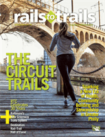
Shelby Farms Greenline
(Tennessee)
Family outings don’t come much bet-
ter than excursions on the Shelby Farms
Greenline, which offers an easy bike ride
or walk on a paved, level route that begins
in midtown Memphis and heads nearly 7
miles eastward. The trail is shady and qui-
et, with a wide, unpaved shoulder on each
side. Since opening in 2010, the popular
pathway, which sees as many as 200,000
users annually, has helped inspire a new
culture of biking and walking in Memphis.
Anchored by Shelby Farms Park
( shelbyfarmspark.org ), the Greenline
provides a unique connection to nature
for city dwellers. One of the largest urban
parks in the country, Shelby Farms spans
a whopping 4,500 acres and abounds in
woodlands, wetlands and lakes. The park
even contains a herd of buffalo! The young
and young at heart will enjoy its immense
and whimsical Woodland Discovery
Playground, horseback riding stables, disc
golf and zip-lining courses, watercraft rent-
als and hiking trails.
Building on the positive momentum of
the Greenline, Shelby County and Shelby
Farms Park Conservancy broke ground last
summer on a 4-mile eastward extension of
the trail. Once it reaches the former rail-
road depot in Cordova (expected to hap-
pen in fall 2016), the corridor will cover
10.5 miles, making it the longest rail-trail
in the state. If added to the Rail-Trail Hall
of Fame, it also will be noteworthy as the
first rail-trail in Tennessee to make the list.
GETTINGTHERE:
Memphis International
Airport (MEM) is less than 20miles from
the trail.The Greenline is accessible from
multiple points, but many visitors will want
to start on its east end in Shelby Farms Park
(500 N. Pine Lake Drive).To get to the park
from the west:Take Interstate 240 to the
Walnut Grove exit and go east to the third
stoplight.The park is on both sides of the
road.Turn left at the light. From the east:
FollowWalnut Grove or Mullins Station
Road until you see signs for the park.
MORE INFO:
shelbyfarmspark.org/shelbyfarmsgreenline
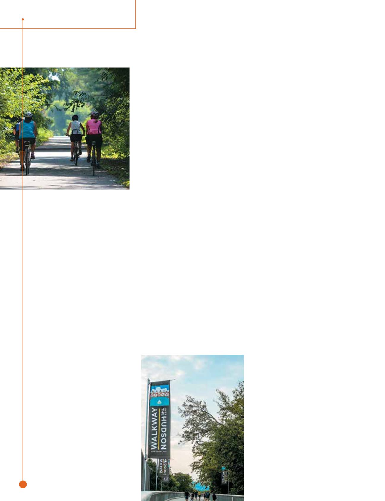
Hudson Valley Trail
Network
(NewYork)
Offering an unforgettable experience of
beauty, adventure and charm, the Hudson
Valley Trail Network encompasses the
Walkway Over the Hudson, Hudson
Valley Rail Trail and William R. Steinhaus
Dutchess Rail Trail.
The magnificent Walkway Over the
Hudson provides a journey through the
sky. The longest elevated pedestrian bridge
in the world, it spans just over a mile
across the Hudson River and yields dra-
matic views of the river more than 200 feet
below and of the surrounding New York
countryside.
A glass-walled elevator takes visitors
on a 70-second ride back to the ground,
where they can catch the Dutchess Rail
Trail on the river’s east bank. The trail
winds through Poughkeepsie and contin-
ues southeast for 13 miles, ending at the
restored Hopewell Depot (
hopewell
depot.org ), which serves as a visitor cen-
ter and museum. A unique feature of the
trail is its Military Mile, honoring the five
branches of the U.S. military—Air Force,
Army, Coast Guard, Navy and Marines—
through special signage.
On the Walkway’s west side, travelers
will find the quaint hamlet of Highland,
with its charming shops and eateries.
From there, the Hudson Valley Rail Trail
heads northwest through hardwood forests
and rock cuts and under two picturesque
stone-arch bridges. After nearly 4 miles, it
ends in the town of Lloyd. Two cabooses
along the route, one dating from 1915
and the other from 1926 (this one housing
historical exhibits), present a tangible con-
nection to the trail’s railroad past.
Together, the three rail-trails, total-
ing 18 paved miles, provide an easy and
spectacular way to experience the Hudson
Valley.
GETTINGTHERE:
The HudsonValley trails
are about a two-hour drive fromNew
York City.They also can be reached by
train; take Amtrak or a Metro-North train
(the Hudson Line) fromGrand Central
Station inManhattan to Poughkeepsie.
TheWalkway Over the Hudson is a few
blocks from the station (about a 15-minute
walk). If flying in, the closest major airport
is Stewart International Airport (SWF) in
Newburgh, about 25 miles from the trail
system.
MORE INFO:
walkway.org,hudsonvalley
railtrail.netand
dutchesscountytrails.comGHS Swamp Rabbit Trail
(South Carolina)
In the backyard of two major Southern
cities, Atlanta and Charlotte, N.C.,
Greenville’s Swamp Rabbit Trail is an eas-
ily accessible treasure in the foothills of
COURTESY SHELBY FARMS PARK CONSERVANCY
KRISTINA QUINONES
rails
to
trails
u
spring/summer.16
28
destination